Handy GPS v44.3 – GPS application for navigation and route planningاندروید
Please read the user manual before using the application.
This application is designed to help you navigate and plan routes in a user-friendly manner using various map sources available within the application. It supports multiple coordinate systems and provides accurate positioning and navigation features for both land and marine applications. The application is compatible with various devices and offers a range of customizable settings to enhance user experience. Please ensure to check for updates regularly to benefit from the latest features and improvements. The Handy GPS application is developed by BinaryEarth and is available for just $6.99, providing a comprehensive GPS solution for users.
Some features of the Handy GPS application:
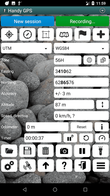
- Supports both metric and imperial/US measurement units for distance and area calculations.
- Allows users to import and export data in various formats including KML and GPX.
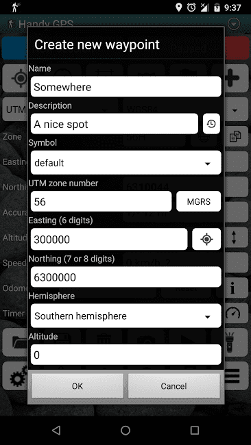
- Provides coordinate conversion between UTM and other formats for easy data management.
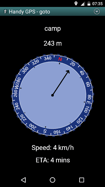
- Enables users to set waypoints and navigate to them using the “Goto” feature.
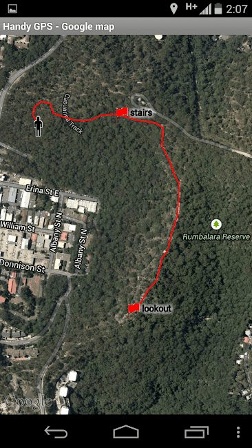
- Includes a built-in map viewer for viewing locations on the map.
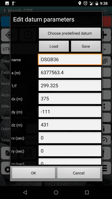
- Offers various geodetic systems including WGS84, AGD66, AGD84, GDA94, AGD, GDA, AMG, and MGA. (You can switch between these systems for accurate positioning).
- Allows users to view their position on MGRS grid references.
- Provides easy access to GPS data for offline use.
- Offers various formats for exporting GPS data.
- Supports easy navigation to selected locations on the map.
The Handy GPS application is designed to provide users with a comprehensive GPS solution to enhance their navigation experience and ensure they have access to all necessary tools for effective route planning and navigation.

-
Version changes 44.3
44.1: Added options to change the colour of reference set tracklogs and also to draw them as polygons instead of polylines.
43.8: Fixed issue which was preventing the app from opening GPX files from emails.
43.7: Updated to target Android SDK 35, which required updating minimum supported Android version to 5.0 (Lollipop).
43.6: When saving tracklogs to a GeoJSON file, save as LineString instead of Polygon object.


Rules for sending comments
ClosePost a comment
Related
0