World atlas & map MxGeo Pro v9.3.6 – Your gateway to the world of maps!
Important rules for using the application
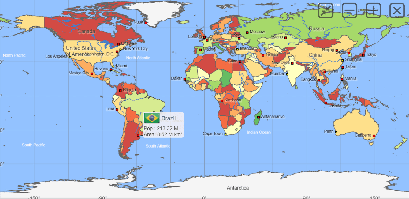
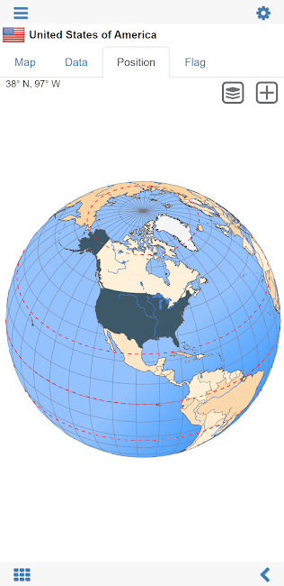
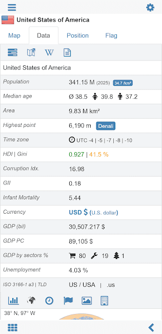
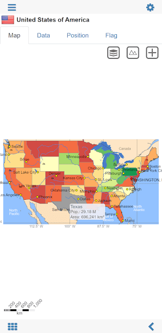
World atlas & map MxGeo Pro is a comprehensive tool for those who want to explore the world through maps and geographical data. It provides a wide range of features, including detailed maps, satellite imagery, and extensive geographical information. This application is developed by HPB Labs to help users navigate the world effectively. The application includes an extensive library of over 240 maps that offer a detailed look at various regions and countries. Users can easily zoom in and out to see the intricate details of each map and get a better understanding of the geographical context. This tool is designed for both casual users and professionals who need accurate and up-to-date geographical information for their projects. Whether you are planning a trip, conducting research, or simply exploring, this application will provide you with the necessary tools to enhance your geographical knowledge.
Features of the World atlas & map MxGeo Pro application:
- Over 240 detailed maps covering various regions
- High-resolution satellite imagery for better visualization
- Comprehensive geographical information for users
- Interactive maps that allow users to zoom in and out
- User-friendly interface that is easy to navigate
- Access to various geographical data and statistics
- Seamless integration with other applications for enhanced functionality
- Regular updates to ensure the information is current
- Offline access to maps for users on the go
- Customizable map settings for personalized experience
The World atlas & map MxGeo Pro application is a must-have tool for anyone interested in geography and exploring the world. It is designed to provide users with the best experience and the most accurate information available. The application is compatible with version 2.00 of Android 3.8 and above and is available for download on Apkopia for free.

-
Version changes 9.3.6
• Updates and corrections for maps and data
• Bug fixes and improvements9.x:
• World and continent maps of climate classes
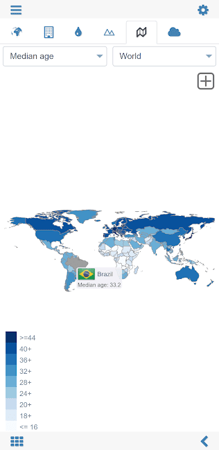
• Country comparison: charts for time series based data
• New chart: Population distribution8.x:
• Print maps and country data
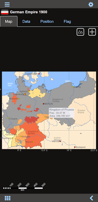
• Historical world and continent maps of 1900, 1930 and 1960
• Search for countries, major cities, rivers, mountains, islands, lakes and coordinates
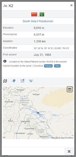
• World Explorer: largest cities, longest rivers and highest mountains


Rules for sending comments
ClosePost a comment
Related
0